
With most of the attention on skiing, snowboarding, and mountain biking, it’s safe to say that hiking is one of the most underrated activities at Snowshoe. The resort’s 11,000-acre backcountry is home to a wide variety of unique trails that take full advantage of the mountain’s drastic landscape.
The Lake Trail


Hiking at Snowshoe Mountain
One of Snowshoe’s most family-friendly hiking options, this 1.25-mile loop trail circles Shavers Lake with minimal elevation change along the way. The Lake Trail offers spectacular views of the Snowshoe Basin as well as ample opportunities to see wildlife. To access the trail, take the Ballhooter lift down to the lake and look for the trailhead to the right.
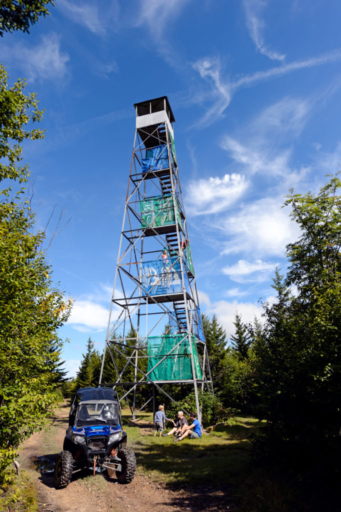
The Fire Tower
Perched high atop Cheat Ridge, the Snowshoe Fire Tower offers an absolutely breathtaking 360-degree view of the surrounding area. There is more than one way to get there, with Bail Out and 6,000 Steps being the two top options for hikers. Bail Out is the shortest route, but also the most strenuous, climbing quickly from the Lake Trail straight up the ridge to the fire tower. 6,000 Steps follows an old rail grade, climbing gradually from the bottom of the Soaring Eagle lift to the Cheat Ridge Trail. Combine them for an epic 3+ mile loop.
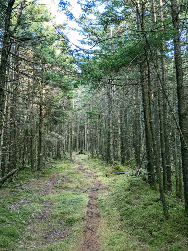
Enchanted Forest
If you’re looking for solitude, the aptly named Enchanted Forest could be the perfect hike for you. This trail follows the ridgeline north of the Silver Creek area ski slopes, along a remote edge of Snowshoe property. Dense red spruce trees keep the forest here dark and cool, while vibrant, green moss covers everything in sight. To access the Enchanted Forest, start by traversing the ski slopes on Black Run Road for approximately 2 miles to the beginning of Enchanted Forest. Follow the trail for another 1.1 miles before either turning around and heading back the way you can or descending the ridge down Headset Adjustment and linking back to Black Run Road via Lower Beaver Dam, for a 6.3-mile loop.
The Airport
Last but not least on our list is the Airport. No, it’s not a real airport, but the views from the summit are almost like looking out the window of an airplane. Located on the backside of the Silver Creek area, this hike serves up some seriously wild and wonderful panoramic views of Snowshoe, Slatyfork, and beyond. As with most hikes on the mountain, there are multiple routes to get there. Our recommendation is to start out on Black Run Road before climbing the access road to the top of Silver Creek. Continue past the Ski Patrol shack behind the Flying Eagle lift until you pop out on top of the Airport. After you take in the view, continue along the high bald to Upper Beaver Dam, and then circle back to where you started via Black Run Road for a 3.3-mile loop.

Remember to Adventure Safely
Please keep in mind that Snowshoe’s backcountry trails are in remote areas generally without cell phone service. Hike or ride with a partner and let a responsible party know where you will be and when you plan to return. Be sure to familiarize yourself with Snowshoe’s backcountry map and have a plan.
Be sure to take enough water for your entire group as potable water is unavailable in the backcountry.
Never approach or feed wildlife. Confrontations are best handled by staying calm and backing away slowly. Always avoid making wildlife feel threatened.
All of these trails are designed for hikers, mountain bikers, and other activities. Please be courteous to all other trail users.